Easy Earthworks ™
Earthworks cut & fill software
hyper accurate earthworks
calculation made simple!
Effortless cut & fill measurement for construction projects
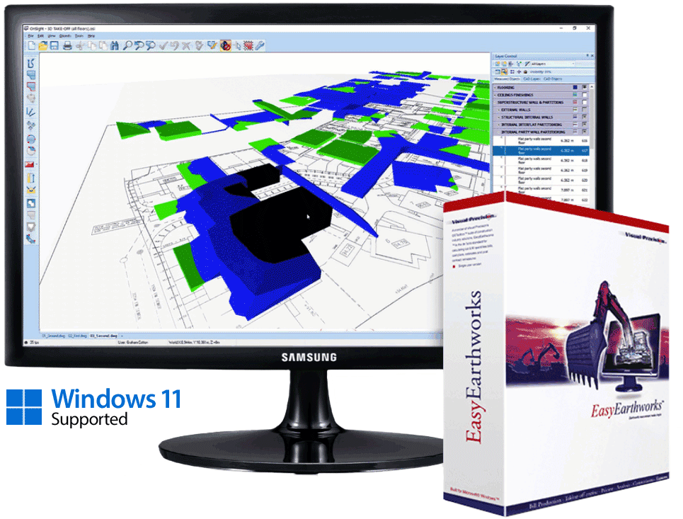
Stop guessing and take control of your earthworks calculations with EasyEarthworks™, the cut & fill software trusted by groundworks contractors, quantity surveyors and civil engineers. Measure cut volumes, fill volumes, topsoil stripping and more directly from your drawings - supporting PDF, CAD and scanned files. No manual scaling, no slow, error-prone workflows.
Load your plans, add contours, hit “calculate” and get accurate cut & fill results in minutes - not days. On a typical multi-acre site, what used to take hours can now be done in under 30 minutes.
EasyEarthworks™ - fast, precise cut & fill calculations every time!

Why construction professionals choose EasyEarthworks™️ software?
Groundworks contractors, quantity surveyors, and civil engineers rely on EasyEarthworks™ to simplify one of the most complex and time-consuming aspects of site preparation: calculating cut and fill volumes accurately.
EasyEarthworks™ applies advanced calculation rules, handles multi-level drawings and automates contour and level extraction - so you spend less time manually measuring and more time planning and analyzing your project with confidence.
How EasyEarthworks™️ will improve your cut & fill
|
Accurate bulk cut & fill calculations |
|
Estimate civil-earthwork quantities |
|
Produce client-ready deliverables |
|
Manage complex projects with ease |
|
See your site with total clarity |
|
Professional outputs, every time |

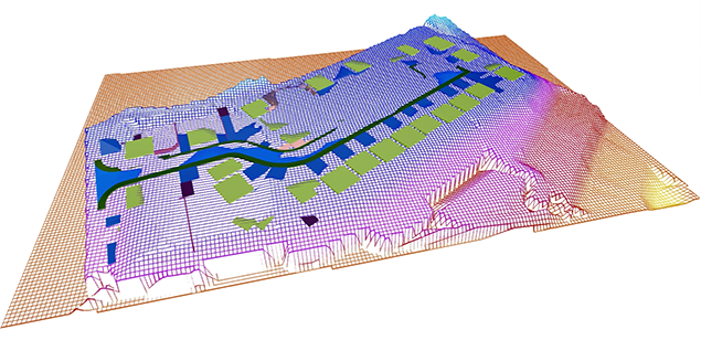
Unmatched accuracy you can always trust!
EasyEarthworks™ delivers precision you can rely on. Using advanced calculation algorithms and built-in methodology compliance (SMM7, NRM2), it ensures cut, fill and topsoil volumes are measured accurately every time.
Automatic calibration, level extraction and intelligent contour handling reduce human error and eliminate guesswork - giving you defendable, audit-ready results for tenders, cost plans and final accounts. With EasyEarthworks™ you can be confident that every calculation reflects the true requirements of your project.
Highly flexible useability & scaleability
Lorem ipsum dolor sit amet, consectetuer adipiscing elit, sed diam nonummy nibh euismod tincidunt ut laoreet dolore magna aliquam erat volutpat. Ut wisi enim ad minim veniam, quis nostrud exerci tation ullamcorper suscipit lobortis nisl ut aliquip ex ea commodo consequat. Duis autem vel eum iriure dolor in hendrerit in vulputate velit esse molestie consequat, vel illum dolore eu feugiat nulla facilisis at vero eros et accumsan et iusto odio dignissim.
Lorem ipsum dolor sit amet, cons ectetuer adipiscing elit, sed diam nonummy nibh euismod tincidunt ut laoreet dolore magna aliquam erat volutpat.
Duis autem vel eum iriure dolor in hendrerit in vulputate velit esse molestie consequat, vel illum dolore eu feugiat nulla facilisis at vero eros et accumsan et iusto odio dignissim.
Frequently Asked Questions:
|
Q: What file formats does EasyEarthworks™ support? |
|
Q: What types of earthworks volumes can EasyEarthworks™ calculate? |
|
Q: Can EasyEarthworks™ handle multiple drawings and project revisions? |
|
Q: Does EasyEarthworks™ include 3D visualisation? |
|
Q: How precise are the cut & fill results from EasyEarthworks™? |
Hardware to enhance your workflow
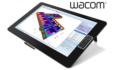
Wacom Cintiq Pro32 Touchscreen
The Wacom Cintiq Pro 32 features a premium 4K screen with world class colour performance and virtually no parallax. Wacom Cintiq Pro 32 gives you something priceless: space. Combined with Wacom Pro Pen 2, it offers an experience designed to enhance every creative breakthrough.
trusted by the world's largest (and smallest) construction professionals
![]()